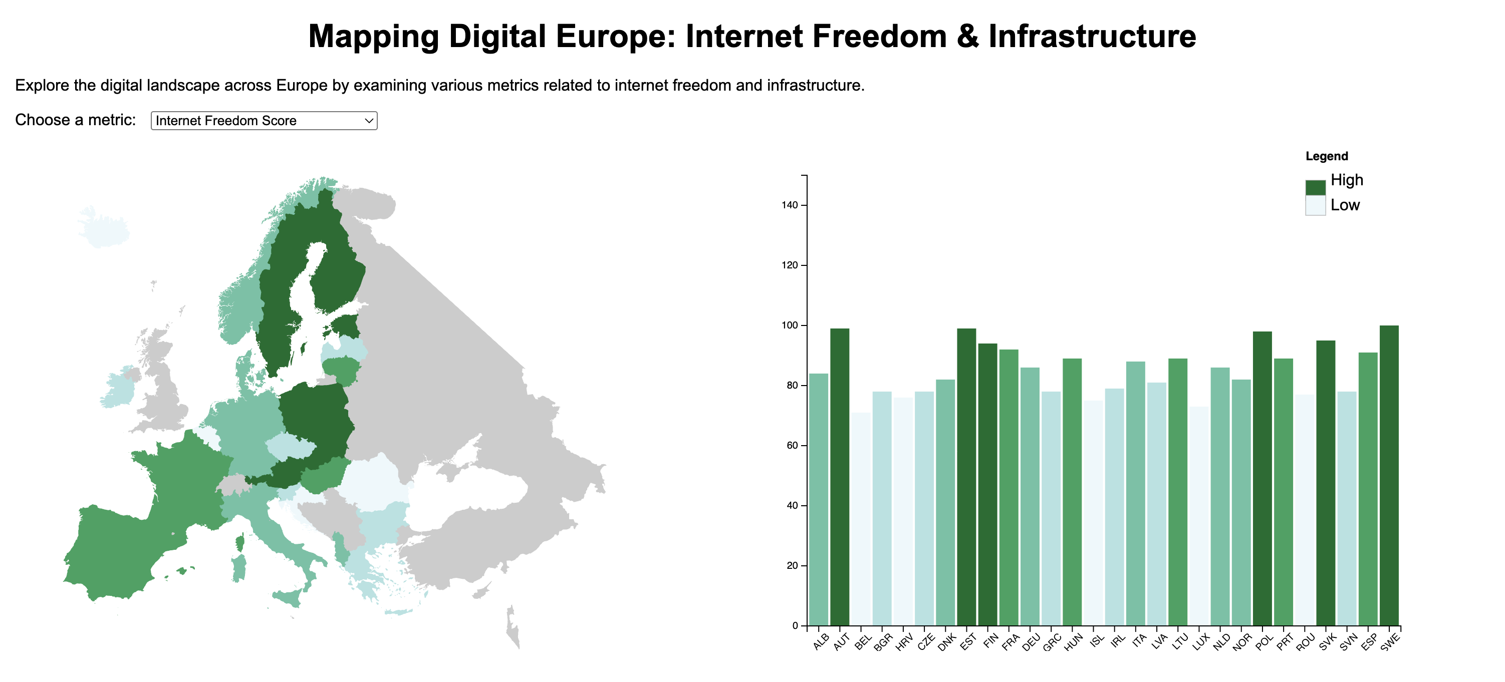
Mapping Digital Europe
Coordinated choropleth + bar chart (D3) exploring internet access & freedom across Europe.
View project →
Coordinated choropleth + bar chart (D3) exploring internet access & freedom across Europe.
View project →
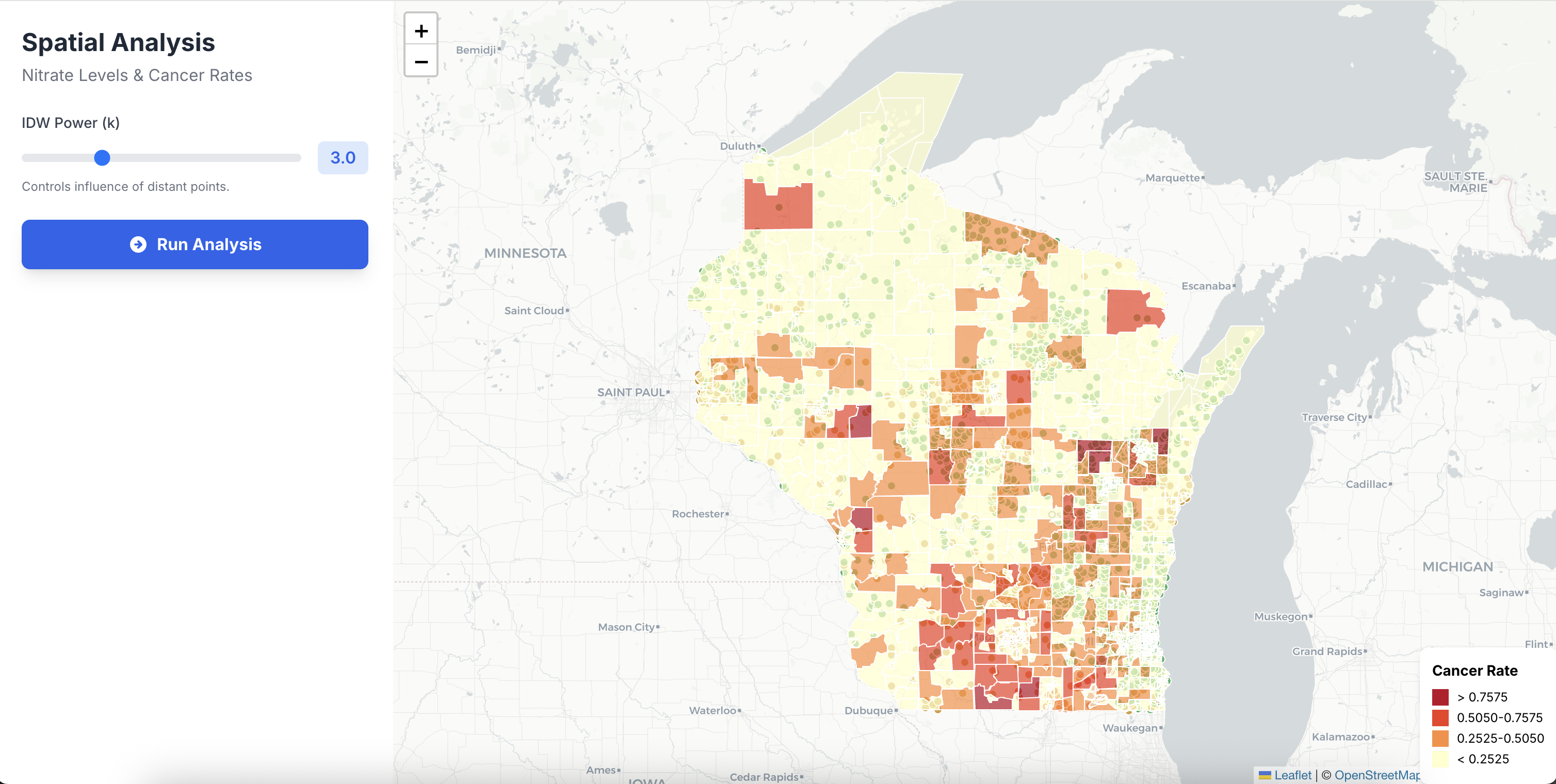
Leaflet app with client-side IDW and regression to explore nitrate levels vs. cancer rates.
View project →
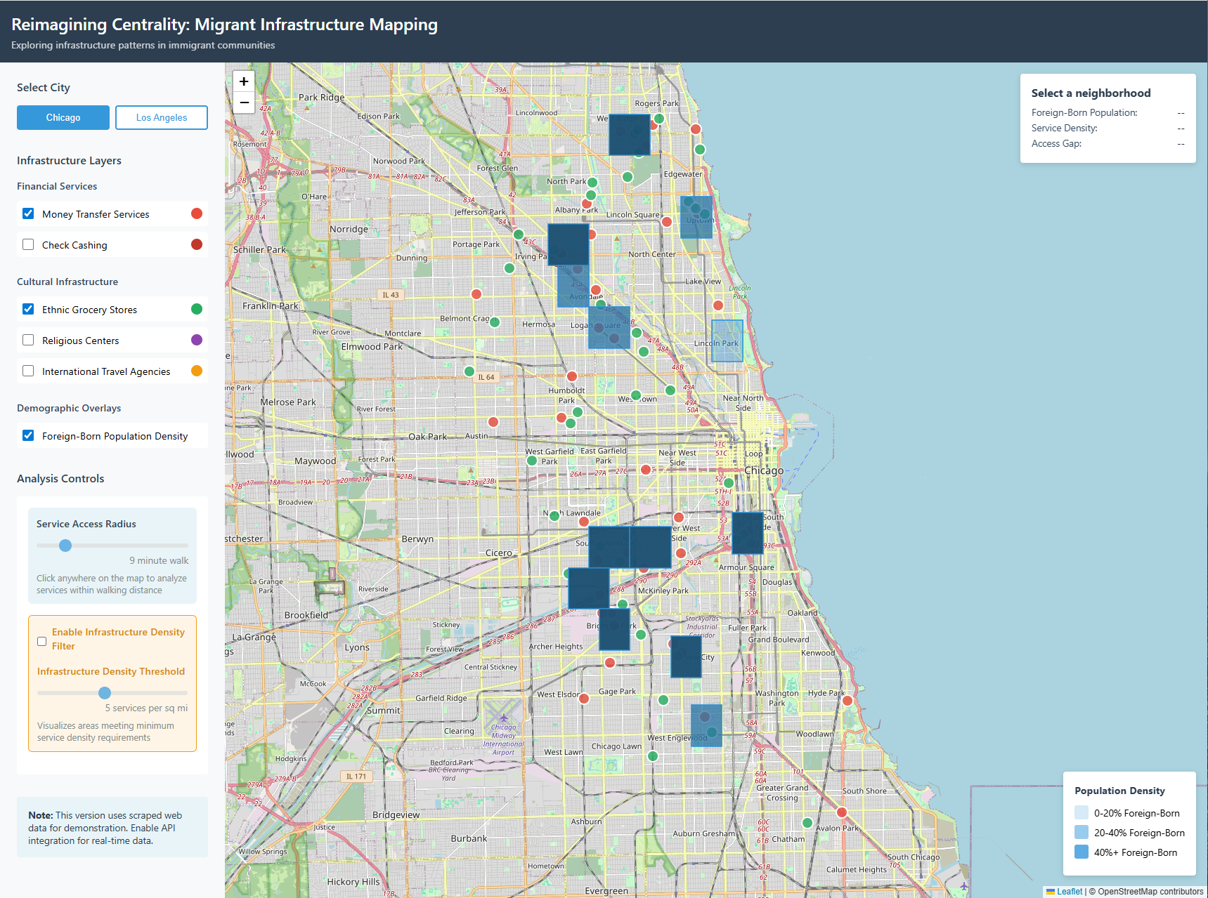
Prototype mapping migrant-serving amenities using Central Place Theory as a lens.
View project →
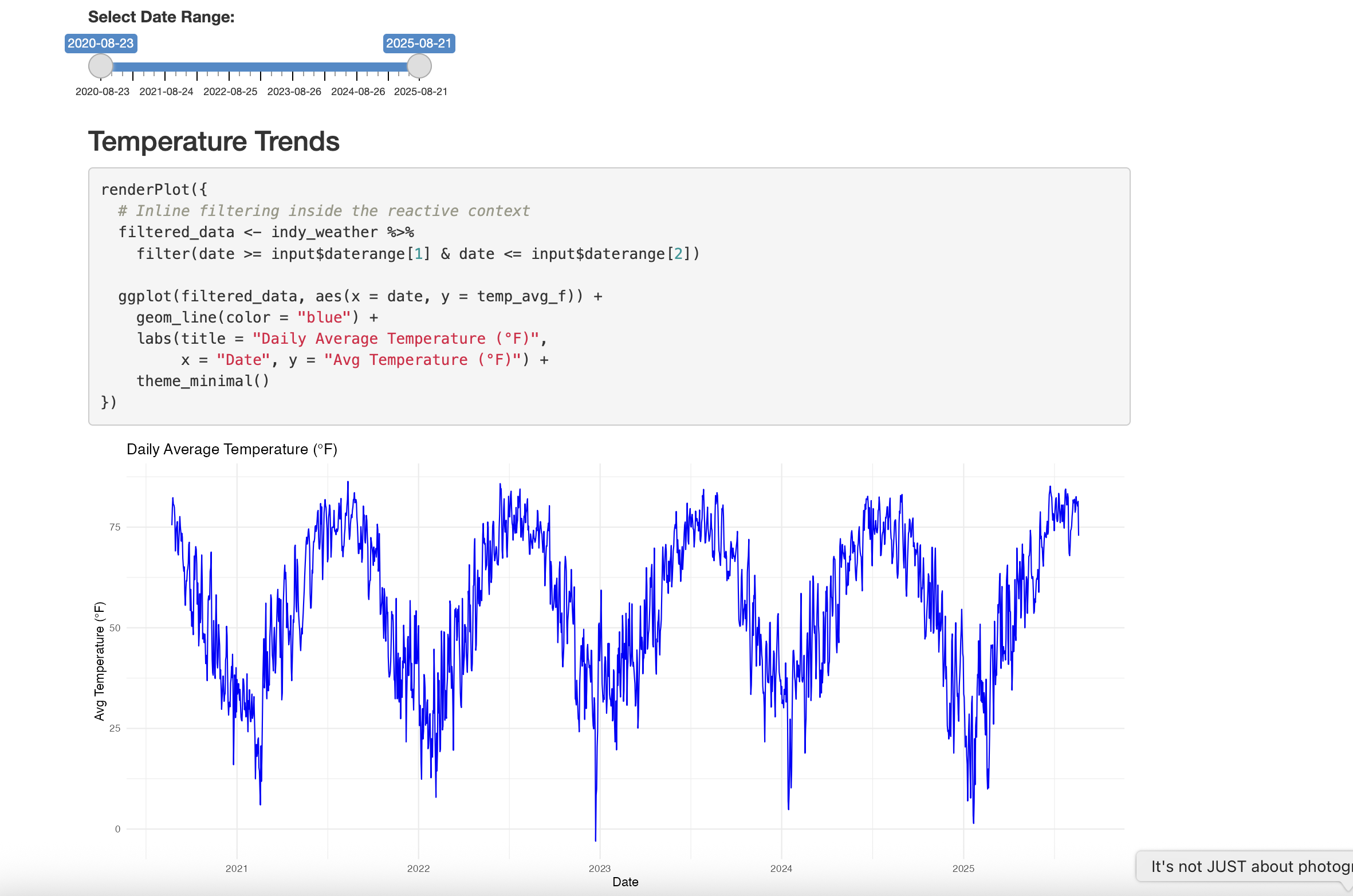
R + Quarto dashboard analyzing Indy weather 2019–2023 (Open-Meteo API).
View project →Versatile IT consultant and GIS Developer with proven success in cloud infrastructure, CRM systems, and data management, delivering scalable solutions that enhance operational efficiency and support international business growth.
Email: [email protected]
Location: Indianapolis, IN · Available for remote/hybrid